 JAVIER MOSQUERA GONZALEZ Architects
EUROPAN 12
Type: Open international competition.
Location: Bitterfeld-Wolfen. Germany.
Year: 2013.
Program: Urban development. Housing.
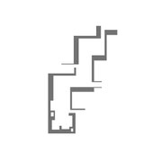
Size: 3.700m2
Coauthors: Juan Enrique Álvarez. Alfonso Peralta.
A DEGRADATED LANDSCAPE
The Bitterfeld-Wolfen area has suffered throughout the last century a thorough decay proc- cess which has affected its essential nature. We believe in the regeneration of the landscape as a first step, which may facilitate the regeneration of the leisure and cultural opportunities, and influencing the strengthening of the social tissue. The action of man can, if aimed in the right direction, restore the exploited, contaminated and degradated environment and turn it, by big scale, landscape actions into an armonic artificial/natural landscape. Thus, by filling a former minescape, a radical new landscape is generated, where the memory of the excavation and exploitation of land has its counterpart in the waterscape, and the chance to provide a massive water extension.
THE IMPORTANCE OF WATER.
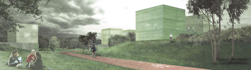
The Goitzschesee is the new full-potential landscape tool. It will work as a generator of sport and leisure activities. Its capacity to regenerate the area, by acting as an attractor is yet unforeseeable. We try to stimulate the activity and connections in the thin changing line that divides water and land. This line will support a great intensity of use, and it is also an attractive opportunity land to set “landscape buildings” a new concept for disgregated minor scale buildings that could resemble landscape art operations.
THE PATH STRATEGY
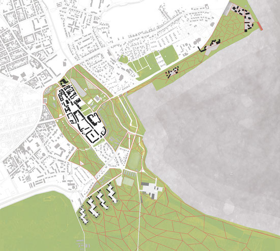
The weaving of the urban and landscape areas relies in great part in a network of intertwin- ning paths, which connect nodal city areas, such as the “new centrality” area represented as zone 2, the stadtzentrum and the big natural reserve that is the planned forest adjacent to the lake.
These paths, that can be used by either pedestrian or cyclists, configure a different approach to the inherent flows in the city. These “green- ways” allow the citizens to move from house to work or to the leisure area without abandoning the feeling of walking through a park, even though they will be crossing through the different layers of the city.
GREEN WEDGES
The city growth is organized by the surrounding forest enhancing its presence, carrying the sense of the countryside along green wedges where paths run weaving the urban fabric and the forest.
INSERTION
The city extension is inserted in the forest creating urban habitats which support the green wedges. Thus, road and pedestrian circulation keep separated so, without overlapping, the housing is integrated in the forest and the forest is carried to the urban fabric.
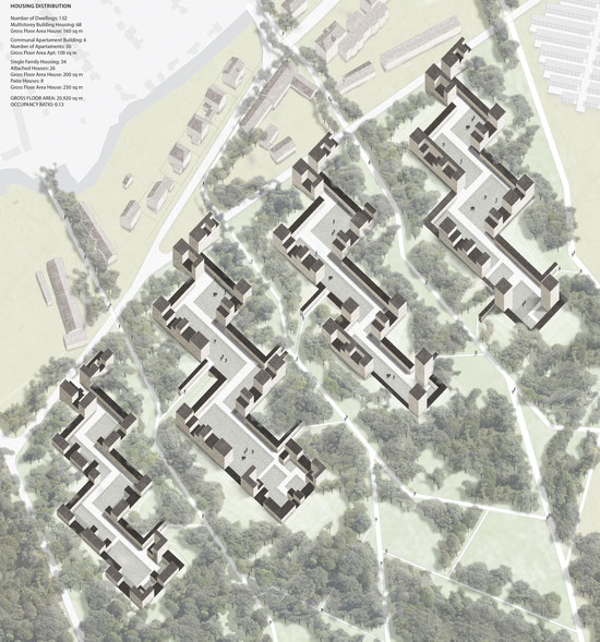
CLUSTER
The dwellings are gathered in the new habitats in density enough to support community facilities encouraging the community life in the complex. Road network ends inside the habitats linking clusters to downtown, and pedestrian paths link the inner urban landscape to the forest path network, joining the habitats to the country landscape and to the lakeshore.
CONNECTION
The dwelling is conceived as a device which connects home life to the forest surroundings, yet belonging to the urban habitat. Wide windows and open terraces connect both the forest and the city, adapting the housing to weather conditions.
ENVIRONMENT
The housing clusters are drafted by the environment conditions. Thus, while the buildings are free housing on the ground floor to prevent flooding damages, the dwellings are topologically on the ground. Different types of spaces, integrated on each dwelling, provides room enough to support sport facilities on the ground floor and easy connection to the forest and lakeshore. Also the sunlight transforms the habitats into a ninety degree building settlement as a result of facades facing southeast and southwest.
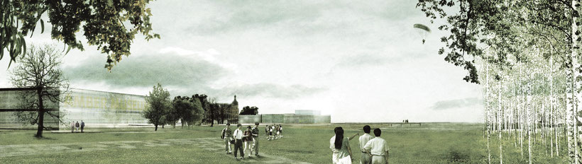
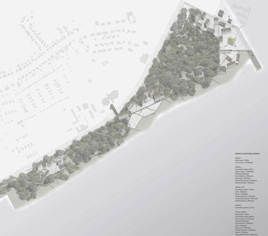
LINKING TWO POINTS. A PATH CLOSE TO THE LAKE
The zone B goes trough a linear axis over 1 km long. The proposal tries to link the city and the existing sportive port by a landscape scale action. A path with one direction and multiple visions. On one side, an areas full of trees protecting the area from the noise of the road close to it, and on the other side the lake, symbol of the new city of Bitterfeld-Wolfen. Opening this element to the water and the same time creating a public space is a very important change in this area. And it is made just with a net of paths, that can be developed in several stages, and some cluster with different activities placed all trough this new public facility.
URBAN PARK. MULTIPLE PATHS. MULTIPLE OPTIONS
The new landscape of the zone B is defined by an amount of local trees and a net of paths linked with the main way. The paths are linked together, creating green spaces where practicing sports, playing with the kids or just having a rest. Pedestrians and bycicles can go trough them, leaving the car far from the water. In both ends of this path, there are defined two public parking areas, one of them close to the port and loft facilities, and the other one close to the hotels and restaurants. By doing this, we give Nature its own space, bringing back together both city and nature.
PUBLIC ACTIVITIES CLUSTER TROUGH A PATH
All the activities that can be made in this area, will attract people and new visitors to the city. According to this, the action to be developed will improve the economy of the city in a direct way. By creating these clusters, in different stages, we try to ensure a constant activity in the area. Buildings divided in smaller parts, thought as fast and cheap elements to be built when the economy allows it. Those intermediate spa- ces between buildings create areas for people and not for the car, not just nature but also a part of the city in it. Lofts for young people, port facilities, museums, one of them linked to the existing on the other side of the road, shops, restaurants and some hostels and hotels. A net of paths with activity clusters for the people, in the nature, in the city.